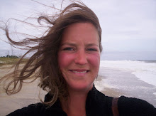
Along the way, on the Atlantic Coast
We were just plodding along, taking advantage of the north west wind, with the head sail up,
I played the fiddle for a bit, but i broke my d string again right away.

Then while talking amongst ourselves and one of the temporary crew members with us, Andrea, mentioned that she thought it would be neat to see some dolphins, and someone told her “Nah, dolphins don’t make it this far north, we won’t see any here” And I swear not even ten minutes later. . . . . .


if you click on the picture, you can get a closer look
Dolphins! Yes we saw Dolphins, which really it is kinda odd to see them so far north. We also ran into a huge bunch of Jelly fish, tons and tons of them, and a fish ball.
We pulled an all nighter, and off the starboard side we could see the bright twinkling lights of Atlantic City,

and it seems like we saw it forever! I think we were about 20 thirty miles from it, and could still see it 20-30 miles away.

The sunset was amazing! I played the harp while watching Atlantic City slip and disappear into the sunset, only to be seen again from a distance because of the lights from the hotels and casinos.
When At night we all did two hours watches, mine was from 10pm to midnight.
On board we have a handy book called “Skipper Bobs” and it is chalk full of information about marinas and where to shop, stop and eat. It also gives a nice little history about the towns/cities along the way.
While on my watch I flipped through the pages of “Skipper Bobs” and I learned that Atlantic City is a big gambling town, though I already knew that, but it is also known for its awesome boardwalk.
Atlantic City
39°21′54″N 74°26′21″W / 39.364966°N 74.439034°W
Atlantic City is located on Absecon Island, and has over 200 days of sunshine in a a humid subtropical climate.
Atlantic City has always been a resort town, and was incorporated in 1854. There are many historic hotels in the city near the board, a few off the top of my head are, Marlborough-Blenheim Hotel and the Traymore Hotel. These hotels both were inspired a Queen Anne style.
Gambling didn’t really start to become popular until the 60’s in then in 1978, Atlanic City became the first gamble town on the east coast with the opening of the Chalfonte-Haddon Hall Hotel was converted into the Resorts International on May 26th.
Oh and and I thought this was interesting, (please keep in mind I have not had fast food for over a month and I’m craving it and all the msg they use) the founder of Wendy's fast-food restaurant, was born in Atlantic City, his name was Rex David "Dave" Thomas
It was a very pretty night, the stars were out, and so after my watch I slept on the deck again.
I woke up when we entered the Delaware Bay
9/14/09
The Delaware Bay
Not much Action in the Delaware, a few large cargo vessels, a nuclear power plant, and a bunch of huge stationary channel markers.

The shores in the Delaware are lined mostly with salt marshes and mud flats.
The Two Delaware Capes, (a cape denote the outermost boundary of a large bay, where the bay and the ocean meet) are Cape May and Cape Henlopen.
The Delaware Bay is boarded by the state of New Jersey and Delaware.
The C and D Canal (Chesapeake and Delaware Canal)

(entering the C & D Canal)
The C and D Canal is a 14-mile long canal, and it cuts across Maryland and Delaware. It connects the Delaware Bay and the Chesapeake Bay., and as opposed to going around along the Atlantic side the canal cuts commercial and recreational vessel travel between Philadelphia and Baltimore by nearly 300 miles. It is owned and operated by the United States Corp. of Engineers.
After many years of surveying, and funding crisis’s the canal finally opened in 1829. There are many old lift bridges either still in tack and non operational, and some you can see the ruins of them.
We stayed the night at the Summit Point Marina, which was more like a jungle, because the birds were very loud, and we saw all kinds of wild life.

(summit point marina 'the jungle)
I saw a GBH, (great blue heron) my favorite bird.


(GBH in a tree i think)
We had a lovely dinner on the boat. And at night we noticed I all of the HUGE spiders, I slept on deck again, but I think I had nightmares of spiders creepy crawling everywhere in my bag. I made it through the night though, and got soaked from the morning dew.
In the morning I went for a nice long run, it was neat, I found a motor boat graveyard, and then found a road that lead to the canal. I ran (at a faster pace, one of my running goals accomplished, pat on the back ) along the canal, and checked out an old lift bridge. Then some of the crew did laundry, we all showered, got fuel and shoved off for the Chesapeake.
9/15/09
The Chesapeake Bay

(google image)
The late morning on the Chesapeake was very enjoyable; spirits were high amongst the crew and Captain. We left our friends PolarPacer behind, and I’m not sure when we’ll meet again, but they are an enjoyable couple, so I hope we do.
We took a group pole and decided it would be nice to anchor out in the Sassafras River, near Georgetown MD. I mostly wanted to stay there because I liked the name, and I like taking dingy rides. After taking a quick dip, to Shake off the heat of the day, I tried my hand at some Sassafras River fly fishing (not much to write home about on that fishing trip). The fish were surface feeding all over the place, but I’m convinced I had the wrong fly on, I used a green foam double bodied spider (assuming it was popular, according from the HUGE spider night before) it bright chartreuse rubber legs, I thought for SURE it was the ticket. . . . guess again, oh well.

ohno whats that??

About the Chesapeake for a bit
The Chesapeake Bay is the largest estuary in the US, and is about 200 miles long. According to the bartender at the restaurant in Sassafras the name Chesepiooc is an Algonquian word referring to a village "at a big river.
For all you geographers, I did find out that The Bay's geology, its current form, and location was created by a bolide impact event towards the of the Eocene (about 35.5 million years ago!), which formed the Chesapeake Bay impact crater. The “bay” really started forming 10,000 years ago at the end of the ice age when sea levels started rising.

Some very picturesque cliffs were the view most of the time while putzing along in the channel, and they are known as the Calvert Cliffs.
The cliffs are known for releasing fossils such as fossilized shark teeth, from erosion. Also Captain John Smith, straight up from England was one of the first to map the bay between the years 1607 and 1609. The first ever all water national historic trail is located along the Chesapeake and it’s named the Captain John Smith Chesapeake National Historic Trail. ( I think I was running on a part of it when I went for my fantastic long run in the jungle to the lift bridge)
Traveling south in the Chesapeake Bay we start to get into a primarily humid subtropical (meaning we are getting more south YAY)
After a wonderful sleep on deck (not so dewy this time :) ) We lit the fires and kicked the tires, and headed to our next stop, Lovely Annapolis MD.
9/17/09
Annapolis MD
38°58′23″N 76°30′04″W / 38.972945°N 76.501157°W
Coming into Annapolis, you wouldn’t believe all the boats! All kinds of sailboats, motorboats, dinghies fishing boats, crabbing boats, and not a single one of them look shabby, they were all fancy shmancy.
 (a sail boat race on wed.)
Annapolis is the Capitol of Maryland, and was also the temporary capitol of the untitled states back in 1783–1784, cool eh? Annapolis is also home to a US Naval Academy, and St. John's College.
Annapolis was incorporated as a city in 1708, after which many battles and other drama had taken place. 1649 was the year, a explorer named William Stone, came and turned the area into a small settlement known as Town at Proctor's," then "Town at the Severn," and later "Anne Arundel's Towne. Annapolis was re-named from these previous past names, to Annapolis, named after Princess Anne, who later became the Queen of Great Britain.
Annapolis is such a historic town; I don’t even know where to start. We only visited for healthy portion of a day, but we did get out and walk through town a bit, and I got some cool shots.
The State House was constructed in 1772 and is the oldest still in continuous legislative use in the US. The archecture is great, the dome ontop is the largest wooden dome in the US built without nails.The Treat of Paris was ratified there in 1784 and George Washington resigned his commission before the Continental Congress in 1783. Can you believe it! I was in the same town George Washington was!
As we were walking around, I noticed all lot of young people running, and running fast, then I realized that yes, there was a United States Naval Academy nearby on the Severn River. Fort Severn was then founded in 1845.

There are many Historical sites located through out the town, and this one, was the …
The Kunta Kinte- Alex Haley Memorial, which was very close to the harbor/marina. It observes the location of the arrival of Alex Haley's African ancestor, Kunta Kinte. The statues are depictions of the story of Kunta Kinte being told, which is also related in great book by Alex Haley's called Roots.

also Sarah Vaughn one of my favorite jazz singers sand in the restaurant that we ate in.
 (prooofff!)
I also found out from some locals hanging out in the marina that Robert Duvall, one of the captain Mason Pearce’s most favorite actors, lived in downtown Annapolis.
Well, I could go on about Annapolis, but I think I did a pretty good job giving you a taste of it. I highly recommend checking it out.
In the morning we said our good bye to our dear two crew members Andrea and Greg, and sailed away, Goodbye Annapolis, till we meet again!

(bye bye Annapolis)
Our next destination was to get to Norfolk VA, to pick up a new crew member and long time friend of the captain, so we pushed a little bit, leaving early and getting in late.
We stopped in a few smaller towns
9/17/09
Solomons MD
38°20′11″N 76°27′51″W / 38.33639°N 76.46417°W
Solomons Island is located on the north side of the mouth of Patuxent River, and is know for its tiki bars and Naval air Station, on the south side of the Patuxent River.


 (also awesome crab cakes here! so good)
9/18/09
Deltaville VA
We got weathered in Delta Ville for two days, and there wasn’t really a town. I got a little bored, but made myself busy. The weather was windy, not raining at least, and the people at the marina were very friendly. A nice salty sailor gave a us a ride into town, so we stalked up on enough provisions to get us to Norfolk and to make dinner.
 (where we ate in deltaville)


 />
/>