>
9/30/09
North Myrtle Beach
33°49′20″N 78°40′52″W/ 33.82222°N 78.68111°W
We got in to North Myrtle Beach a little late, it was dark out. As we rolled into the marina, we noticed large Casino Cruisers with all kinds of music coming out of them.
We decided to go out to eat at the marina’s restaurant and met a couple who told us that they take people on those casino cruisers three miles out into the ocean so they can gamble. I also learned that Vanna White is from North Myrtle Beach.
Now, not much goes on in North Myrtle Beach, it is mostly just a tourist town, north of Myrtle Beach. But Myrtle Beach, Just south of North Myrtle Beach, is a huge tourist town, with lots of golfing and amusement parks.
10/1/09
Buck Sport, South Carolina
33°40′37″N 79°6′54″W / 33.67694°N 79.115°W
You know sometimes it’s the most remote marinas that don’t have too much of a history where you find most interesting. I had a great time here, I went fishing, Mason and I took a dingy ride and found some sweet old boats, and in the morning I went to a hour run and found a creepy old weird cemetery. Check out the pictures.
 old abandoned boat
 i swear this little river system/jungle had a million old left behind boats, kinda sad
 I went for a run, and found this weird cemetary
 a sod farm being watered, pretty much the extent of my view while on my run
 I went fly fishing off of the dingy and caught a bunch of little pan fish
 a picture of Bucksport in its prime
Bucksport now-a-days
10/2/09
Georgetown, South Carolina
33°22′3″N 79°17′38″W / 33.3675°N 79.29389°W
Georgetown was a really neat place. We got in around four, which gave us plenty of time to walk down town and check things out.
I learned a great deal while walking about, such as Georgetown is the third oldest city in South Carolina. There are many old houses, original street names and tons of informational signs to read and learn about throughout town.
 this sign would be one to take note of (if you click on the picture it makes it bigger and you can read all about it too)
 I'd follow the rules on this one too! (i think Mason is hiding some bread crumbs in his pocket)
 this house was built in 1789
Some say it is here where American History began, in 1526. Rice and indigo were Georgetown’s major crop and trade crop, like many other towns along the coast, The Depression hurt the economy. Then in 1944 they constructed a paper mill, making it the largest in the world.
I talked with a few locals who worked at the paper mill, and it is now starting to shut down, laying off hundreds a people a year. There is also a steel mill that shut down only last year located in the industry area of the town.
10/4/09
Charleston, South Carolina
32°47′00″N 79°56′00″W
Charleston was a very neat city, it is known as the “Holy City” because of the diverse religions practiced throughout the city. Charleston is also the biggest city in South Carolina.
When we pulled up to the dock, I noticed how huge it was, and later realized that one of Charleston’s claim to fame is that its “Home of the Mega Dock”. No lie, it was a mile walk from the boat to shore.

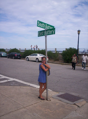
We took a walk along the river front, Saw the Battery Homes and a few other monuments.

Robert Morris, Jr. (January 20, 1734 – May 8, 1806) was an American merchant


With Fort Sumter right outside of the city, Charleston played many roles throughout the Civil and Revolutionary Wars.
 The Customs House
 The Pink House, an old Tavern used by diplomats way back in the 1700's and the 1800's
During the 1770’s Charleston was a major and fourth largest Atlantic port among the colonies. Some things they traded here were mainly rice and indigo. It is located at the confluence of the Ashley and Cooper Rivers.
Charleston has a humid subtropical climate, and very mild winters.
We got weathered in Charleston and let me tell ya, it was blowing and rainy sideways all day. The next day was clear and we headed for Beaufort SC and then Fernandina Beach FL, where we plan to spend some time (a month)
10/6/09
Beaufort SC
32°25′55″N 80°41′22″W
Well came in early and got the chance to take a walk around town, mostly just to look for a post office for post card stamps. Not too much going on in town but it was a neat little town.
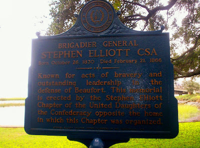
I did get a chance to find a few things interesting about Beaufort.


Parts of Forest Gump were filmed there; also it was named "Best Small Southern Town" by Southern Living and I believe it, it was very southerly
Well with a short stop in Hilton Head Island we will be in Fernandina beach, but from Hilton Head we plan to go out in the Atlantic and skip the Intra Coastal Water way because we’ve heard its pretty shallow. Which means a long 20-18 hour sail.
some silly signs


No comments:
Post a Comment